从 Hostel Brikette 出发的山顶徒步旅行
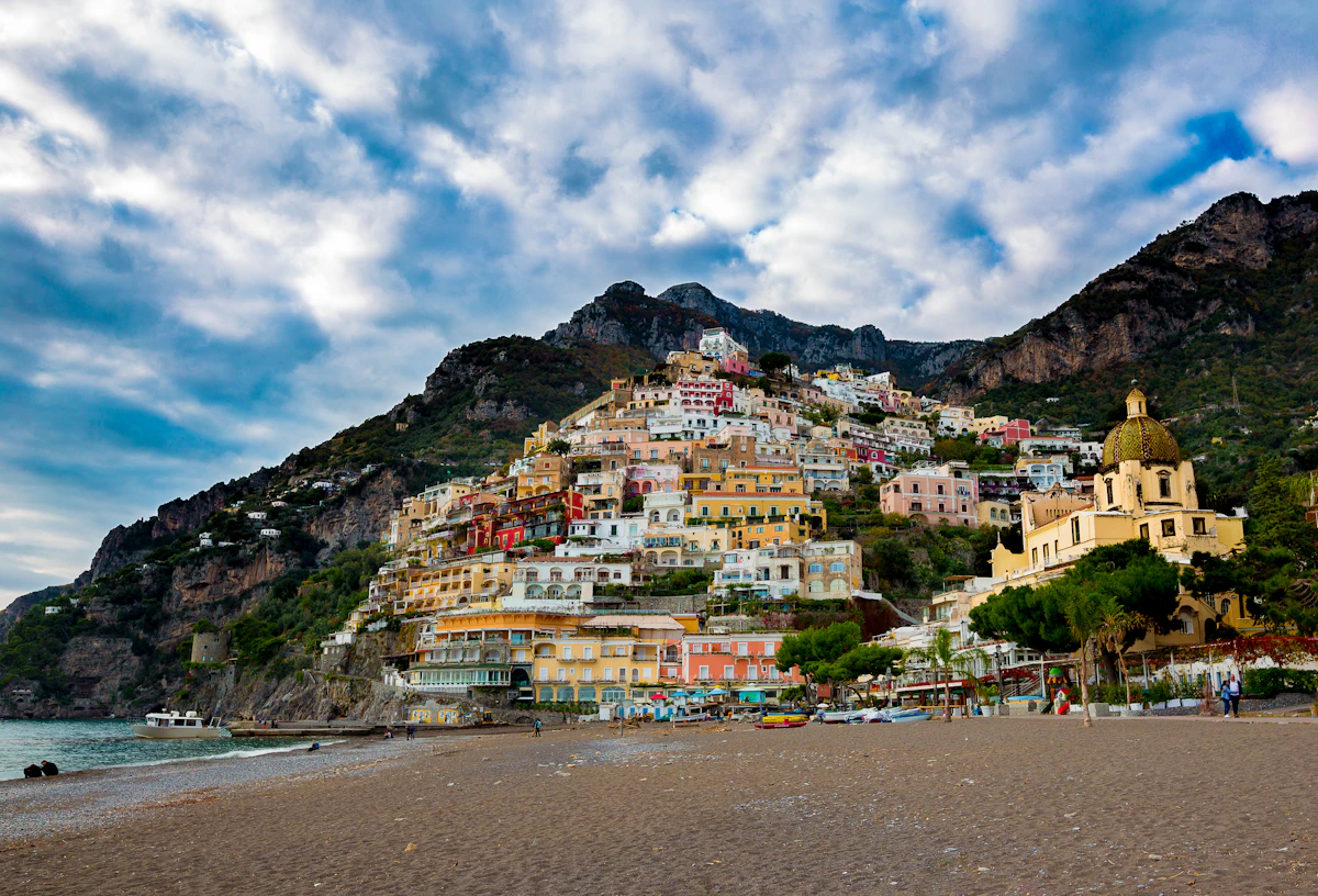
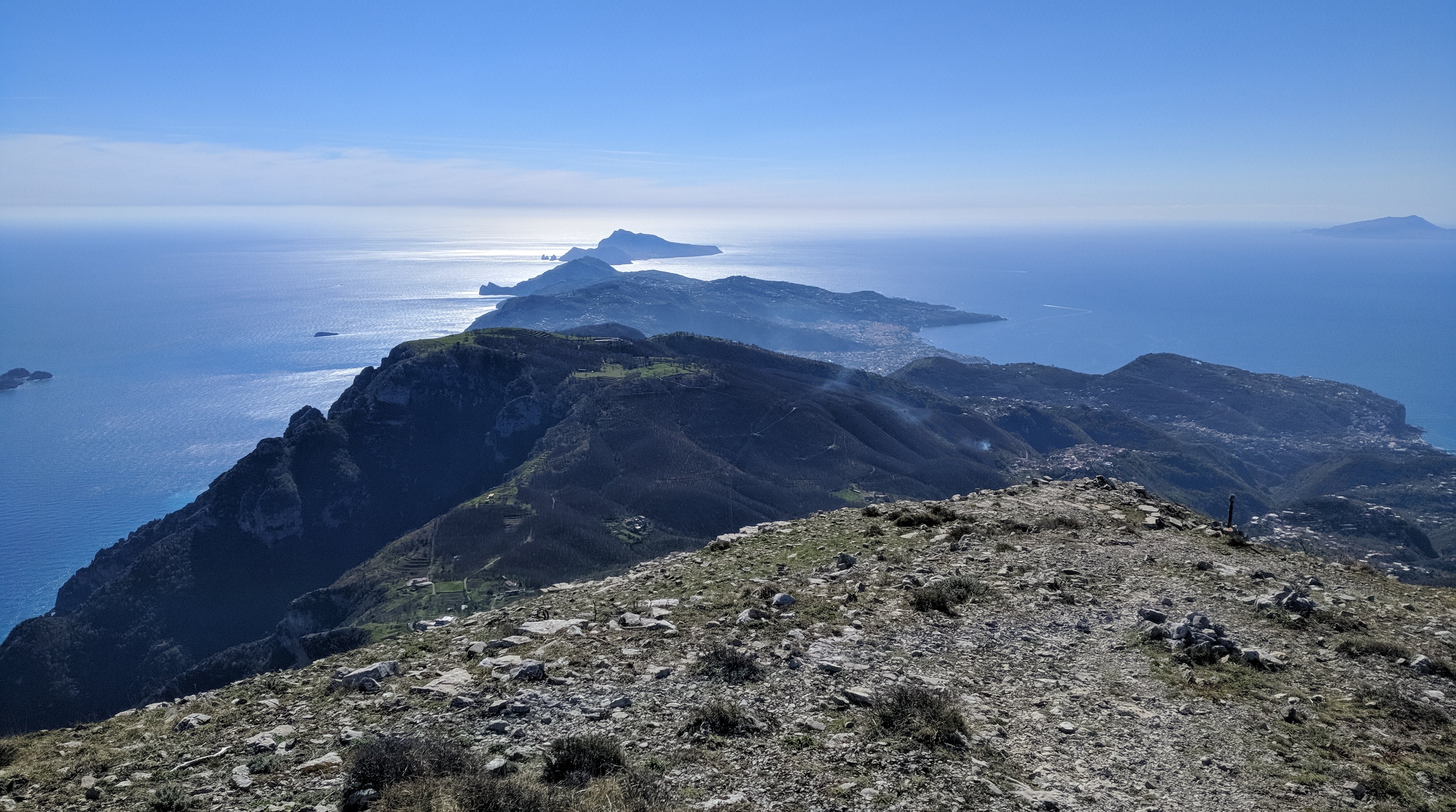
Monte Sant'Angelo towers above the Amalfi Coast and rewards hikers with sweeping 360-degree views stretching from Capri to the Sorrentine Peninsula.
This itinerary starts from Hostel Brikette, guides you up to Santa Maria del Castello, and explains the final push to the summit so you know exactly what to expect before committing.
Why tackle this hike
Views from the summit sweep across the peninsula towards Capri and down the Lattari mountains, making the grind worthwhile for photographers and hikers alike.
Reaching the Amalfi Coast's highest point is a satisfying physical challenge and a story you will trade with other travellers back at the hostel.
The long ascent doubles as a serious cardio session, especially if you are training for bigger treks later in your trip.
Getting to Santa Maria del Castello
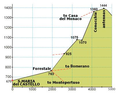
Follow our standard hostel-to-Santa-Maria directions until you arrive in the village; that climb covers just over one third of the total elevation for the day.
Take a breather in the square, refill water if the bar is open, and check that everyone in your group still feels strong before committing to the exposed upper trail.
From Santa Maria to the summit
From the crossroads at the top of the village, turn right up the paved lane until a junction, then turn left and continue past the restaurant until the road bends sharply left.
Leave the road on the right-hand side, following the side path that drops slightly between houses. It will feel like private property at first, but you are still on the right track.
Stay on the mountain trail for an extended stretch until you reach a signed crossroads. Ignore the downhill options and take the steeply rising path.
The ascent quickly zig-zags before easing into a long, flatter traverse along the left-hand side of the mountain face. When you spot stone-cut steps on your right, follow them around the back of the peak for the final push.
Those rock steps lead to the last ramp of the day—keep climbing and you will emerge on the summit plateau with panoramic views in every direction.
Getting to Santa Maria del Castello
Follow the Santa Maria del Castello hike guide directions until you arrive in the village; that climb covers just over one third of the total elevation for the day.
Take a breather in the square, refill water if the bar is open, and check that everyone in your group still feels strong before committing to the exposed upper trail.
Santa Maria → summit (photo guide)
Use this photo to orient yourself before leaving Santa Maria — the upper route is long, markers are sparse, and it’s much easier if your group agrees on the key turns at the start.
Directions from Santa Maria to the Mountain Top
From the crossroads at the top of the village, turn right up the paved lane until a junction, then turn left and continue past the restaurant until the road bends sharply left.
Leave the road on the right-hand side, following the side path that drops slightly between houses. It will feel like private property at first, but you are still on the right track.
Stay on the mountain trail for an extended stretch until you reach a signed crossroads. Ignore the downhill options and take the steeply rising path.
The ascent quickly zig-zags before easing into a long, flatter traverse along the left-hand side of the mountain face. When you spot stone-cut steps on your right, follow them around the back of the peak for the final push.
Those rock steps lead to the last ramp of the day—keep climbing and you will emerge on the summit plateau with panoramic views in every direction.
要点
- 每人至少2升水加上咸味零食;圣玛丽亚德尔城堡之后没有可靠的补充。
- 坚固的徒步鞋,具有抓地力——上层步道的部分是岩石、松散且暴露的。
- 山顶的防晒和分层;即使在温暖的日子里,风也能吹过山脊。
典型费用
- 步道免费;如果您打算在 Santa Maria del Castello 用饮料或小吃奖励自己,预算为 5 欧元至 10 欧元。
- 如果您决定途经另一个村庄而不是一路徒步返回,请返还 SITA 巴士票或渡轮票价。
聪明的时机
- 夏季黎明时分出发,避免高峰期登山;深秋和春天的午后光线较柔和,没有烈日。
- 查看暴风雨预报——云层遮蔽了视野,潮湿的岩石使山顶台阶变得湿滑。
- 在出发前让旅舍的工作人员了解您的计划和预计返回时间。
Step by step
- Climb to Santa Maria del Castello: 使用旅舍的路线前往圣玛丽亚德尔城堡(Santa Maria del Castello);到达正方形意味着您已经完成了大约三分之一的高度。
- Join the mountain trail: 从村庄的十字路口右转,然后左转经过餐厅,然后沿着房屋周围的右侧小路离开道路。
- Commit to the upper ascent: 沿着崎岖的小路到达有标志的十字路口,然后选择直上山顶的路径。
- Navigate the zig-zags: 穿过陡峭的之字形路段,直到小路沿着山的左翼变得平坦。
- Take the rock-cut stairs: 爬上右侧的石阶,在山壁后面绕一圈到达最后的坡道。
- Reach the summit: 沿着最后的上升路线到达山顶,欣赏全景,然后返回圣玛丽亚。
常见问题
How long does the full hike take?
从 Hostel Brikette 出发的往返时间需要 6 至 7 小时,包括在圣玛丽亚的休息和登顶的时间。
Is the trail marked?
圣玛丽亚以外的地方标记稀疏;携带离线地图,注意路口明显磨损的步道和路标。
Can I turn back early?
是的。如果上半部分感觉太暴露,可以从圣玛丽亚或下之字形路段欣赏美景,然后原路返回。