Path of the Gods from Positano: route comparison
Overview
From Positano, choose between reaching Bomerano via Amalfi for the Bomerano → Nocelle traverse, or taking the local bus to Nocelle for an out-and-back. The second option reduces transport changes; it does not remove the trail's exposed sections. Check conditions and the journey home before choosing either.
This overview helps guests at Hostel Brikette compare the three approaches below, then open the relevant detailed route. The Sentiero degli Dei is a mountain hike above the coast, not a beach-level walk. Plan the transport, walking and return as separate parts of the day.
On this page

What is the Path of the Gods, and where does it finish?
The main Bomerano–Nocelle route crosses terraced slopes and rocky coastal terrain. The [CAI Monti Lattari trail sheet](https://www.caimontilattari.it/en/sentiero/327/) identifies it as trail 327, with a listed length of 5.3 km, hiking grade E and a two-hour walking estimate. Those figures describe that trail, not the complete trip from the hostel.
Nocelle is above Positano, not the town centre or beach. Finishing the traverse still leaves a separate local-bus ride or a deliberately chosen walking descent. Keep that last leg in the plan rather than treating arrival at Nocelle as arrival back at Brikette.
Is it suitable for beginners or people with vertigo?
Positano's [official hiking guidance](https://comune.positano.sa.it/novita/comunicati/il-sentiero-degli-dei) describes a moderate hiking route requiring suitable footwear, fitness and mountain awareness, with unprotected exposed sections. Confidence with heights and uneven ground matters; being able to walk around town is not the same preparation.
A Nocelle out-and-back lets you set a turnaround point, but the section you choose can still be exposed. CAI describes [variant 327a](https://www.caimontilattari.it/sentiero/327a/) as avoiding part of the more exposed main route. That is a specific mapped variant, not proof that every shorter walk is suitable for vertigo. Assess the actual route, and use a qualified local hiking guide if you need help deciding.
Recheck the forecast, local alerts and any closure notices before setting off. Poor weather or a closed section can mean choosing another activity, even when a bus is running. An old trail description, an undated status icon or the absence of a search result is not confirmation of access on your day.
Compare the three approaches from Hostel Brikette
Ferry via Amalfi. Use the ferry-route guide for the harbour approach and onward journey. Check [Travelmar's current timetable source](https://www.travelmar.it/en/download-pdf) for your date and direction. A ferry ticket alone does not establish an included or protected SITA connection.
Travelmar also advertises a [combined ferry-and-shuttle product](https://www.travelmar.it/en/how-to-reach-path-of-gods), including a Positano option. Its tables distinguish Bomerano from San Lazzaro: select the actual destination and suitable arrival time, and confirm availability, inclusions and the meeting point. This is a different product from independently buying a ferry and SITA ticket; neither a guided hike nor the Nocelle–Positano return should be assumed included.
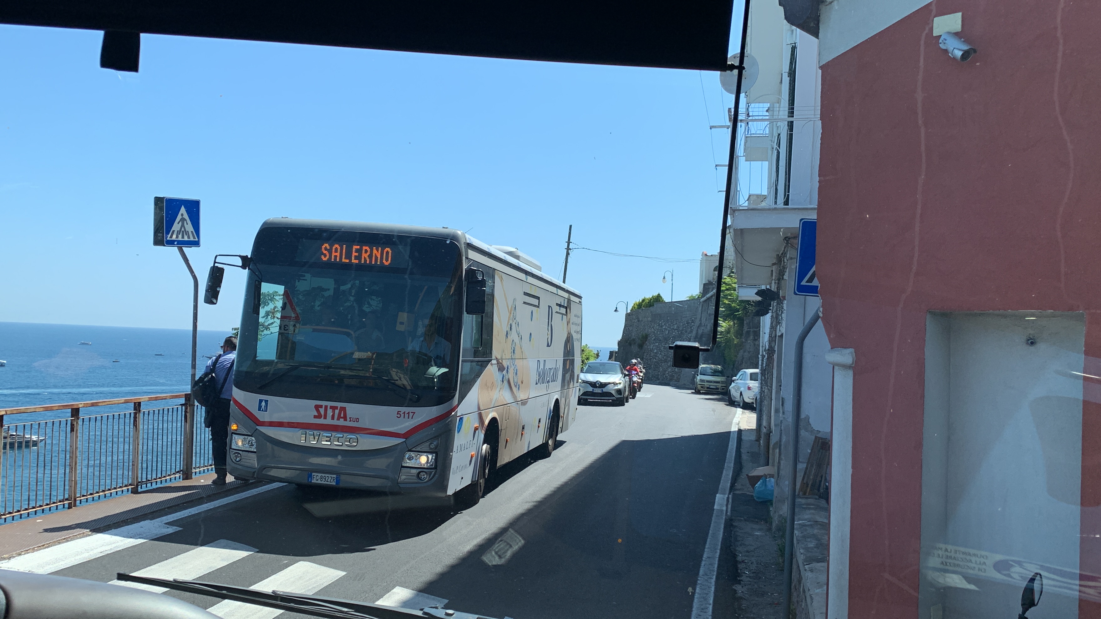
Bus via Amalfi. Use the bus-route guide, checking the actual Amalfi-bound stop in the Chiesa Nuova departure guide. At Amalfi, choose a service on [SITA's Agerola line 5080](https://sitasudtrasporti.it/campania/orari/page/3/) that calls at Agerola (Bomerano). The Agerola name alone is not enough: some branches serve San Lazzaro or other stops. Read the date, day codes and both needed legs rather than assuming a regular frequency.
Nocelle out-and-back. Use the Nocelle route guide for village orientation. Confirm the current Montepertuso–Nocelle boarding point, ticket and return stop locally; this is a separate local service, not SITA 5080. The [Positano tourism office](https://comune.positano.sa.it/amministrazione/uffici/ufficio-del-turismo) points visitors to local transport information and posted QR notices. Do not assume every bus in Chiesa Nuova goes to Nocelle or that a SITA pass covers it.
Buy the appropriate SITA tickets before boarding through an authorised seller or supported digital channel, then follow the [operator's validation or activation instructions](https://sitasudtrasporti.it/campania/faq). A ticket is not a seat reservation. Confirm local-bus and ferry rules separately, including any baggage charges and disruption procedures.
| Approach | Journey and finish | Main planning trade-off |
|---|---|---|
| Ferry via Amalfi | Positano ferry → Amalfi → Bomerano transport → hike to Nocelle → local bus back | Adds the harbour approach and sea-service conditions; confirm the onward bus separately |
| Bus via Amalfi | SITA 5070 to Amalfi → suitable SITA 5080 service to Bomerano → hike to Nocelle → local bus back | Uses road connections and waiting; each leg needs the correct ticket and a workable timetable |
| Nocelle out-and-back | Local Montepertuso–Nocelle bus → walk towards Colle La Serra → retrace the chosen section → local bus back | Fewer transport changes, but the return walk and exposure still count |
Trail length, waymarks and the separate descent
Start the Bomerano approach from Piazza Paolo Capasso using the [municipal route description](https://www.comune.agerola.na.it/vivere_il_comune/luoghi/luogo_16.html) and current CAI mapping. Look for the red-and-white waymarks, and keep the marked trail, village approach and any variant distinct. Save the map offline and follow current signs and barriers instead of improvising from a photograph.
The trail includes rough ground, stone steps and changes in level; one net elevation figure does not describe all the climbing and descending. Plan the chosen variant and a pace that suits your party, with room for breaks and turning back. Do not use a published walking estimate as a guaranteed hostel-to-hostel time.
The often quoted roughly 1,700 steps refer to the descent from Nocelle towards Arienzo, not a direct staircase to Brikette or the same route as walking via Montepertuso. It adds a separate descent and a coastal-road approach. Decide on that route in advance; it is not a convenient fallback to assume after missing the last bus. Confirm the local return stop and use the Chiesa Nuova arrival guide for the final hostel approach.
Plan daylight, weather, supplies and the return
Build a dated sequence: hostel → chosen bus stop or harbour → Bomerano or Nocelle → selected walk and breaks → confirmed return transport → hostel. Add the walking approaches, waits and a missed connection. There is no dependable fixed three-to-five-hour total for every option.
Choose a start and turnaround that leave ample daylight for your whole route and the return. Do not turn a late ferry or a suggestion of golden-hour light into a recommended late start. Check the forecast and local guidance again before leaving; changing from a cancelled ferry to a bus does not make poor trail conditions suitable.
Carry the water, food and weather protection your route needs. Confirm any refill or refreshment stop you intend to use instead of depending on a kiosk, café or farmhouse being open. Keep equipment manageable and your hands free; use poles only where you can handle them without obstructing others.
If your chosen transport, daylight or conditions do not leave a workable day, compare other day trips from Positano. For a hiking-focused stay, read Brikette's actual room and stay information and choose dates that leave flexibility for weather.
What to bring
- Footwear suitable for rough mountain paths, steps and exposed terrain, with sun or rain protection appropriate to the forecast.
- Enough water and food for the chosen route, without relying on every advertised refill or refreshment point.
- An offline trail map, saved transport information, charged phone and the correct tickets for each operator.
- A route and turnaround plan shared with someone, with time for the separate journey from Nocelle back to the hostel.
What to include in your budget
- The correct SITA tickets for every coastal and Agerola leg you choose; check current fares rather than an old per-leg range.
- Any ferry or combined ferry-and-shuttle product, checking exactly what is included and whether the destination is Bomerano.
- The separately planned local Nocelle bus and any applicable baggage charge; do not budget it as a SITA journey.
- Your food, water and any qualified guiding or private transport you choose. A guided tour, transport ticket and trail access are different things; check current access conditions rather than treating a seller's package as a compulsory trail ticket.
Timing and return reminders
- Confirm your return before setting off, with margin beyond the walking estimate.
- Choose daylight and suitable conditions over an attractive but late departure.
- Keep the Nocelle–Arienzo stairs separate from the route via Montepertuso and the hostel approach.
- A shorter out-and-back changes distance and transport, not every exposure or terrain difficulty.
- Recheck current notices and tickets; do not depend on a connection being held or on the final bus.
Step by step
- Choose the actual walk: Compare Bomerano–Nocelle with a Nocelle out-and-back, including terrain, exposure and the separate return.
- Confirm transport and tickets: Check the correct SITA, local-bus or ferry products and actual stops for your date; distinguish a combined shuttle offer.
- Reach the correct trailhead: Use Bomerano's Piazza Paolo Capasso or the Nocelle village approach, with an offline map and current signs.
- Follow your route and turnaround plan: Stay on open marked paths, respond to conditions and allow time for breaks and returning.
- Complete the journey to Brikette: Use confirmed local return transport, or a deliberately planned descent, then the correct hostel approach.
FAQs
How long does the Path of the Gods take from Positano, door to door?
Plan the actual transport, trail section, breaks and return separately. CAI's two-hour Bomerano–Nocelle walking estimate does not include leaving Brikette, waiting at Amalfi or travelling back from Nocelle. A short out-and-back can reduce walking, but no fixed three-to-five-hour total fits every route and date.
Is the Path of the Gods suitable for beginners?
It is a moderate mountain hike with uneven ground and exposed sections, not an automatic beginner walk. Assess your fitness, footing and comfort with heights against the actual route. Starting at Nocelle does not remove exposure. Seek qualified local advice if unsure, or choose a different activity.
What should I do if ferries are cancelled?
First check whether the trail and weather are suitable at all. If they are, compare the actual SITA route via Amalfi or the separate local service to Nocelle, including tickets, capacity, daylight and the return. A spare SITA ticket does not cover every operator or guarantee space.
How much does a Path of the Gods trip from Positano cost?
Add the transport products you actually choose, food, water and any optional guiding. Independent ferry plus SITA travel, Travelmar's combined shuttle offer and the local Nocelle bus have different conditions. Check current fares and inclusions, including the journey home, rather than applying one old per-leg budget.
Do I have to walk the long stairs from Nocelle to Positano?
No: you can plan the local bus from Nocelle, subject to its current service and capacity. The roughly 1,700-step descent towards Arienzo is a separate route, not a direct staircase to Brikette. Walking via Montepertuso is another approach. Choose and check the return in advance rather than assuming any descent will end beside the hostel.